OAC v105.4: Understanding Map Data Quality
OAC 105.4 new Feature "Maps ambiguous location matches" lets you understand the quality of your mapping matches.

Last week Oracle Analytics Cloud v105.4 was announced. One of the features particularly interested me since it reminded the story of an Italian couple willing to spend their honeymoon in the Australian Sydney and ending up in the same Sydney city but in Nova Scotia for a travel agency error. For the funny people out there: don't worry, it wasn't me!
The feature is "Maps ambiguous location matches" and I wanted to write a bit about it.
#OracleAnalytics 105.4 update just about to go live and deploy on your environments. Check-out some of the new features coming. Here is a first list of selected items: https://t.co/Megqz5ekcx. Stay tuned with whole #OAC team (@OracleAnalytics,@BenjaminArnulf...) for more examples pic.twitter.com/CWpj8rC1Bf
— Philippe Lions (@philippe_lions) October 8, 2019
Btw OAC 105.4 includes a good set of new features like a unified Home page, the possibility to customize any DV font and more options for security and on-premises connections amongst others. For a full list of new features check out the related Oracle blog or videos.
Maps: a bit of History
Let's start with a bit of history. Maps have been around in OBIEE first and OAC later since a long time, in the earlier stages of my career I spent quite a lot of time writing HTML and Javascript to include map visualizations within OBIEE 10g. The basic tool was called Mapviewer and the knowledge & time required to create a custom clickable or drillable map was....huge!
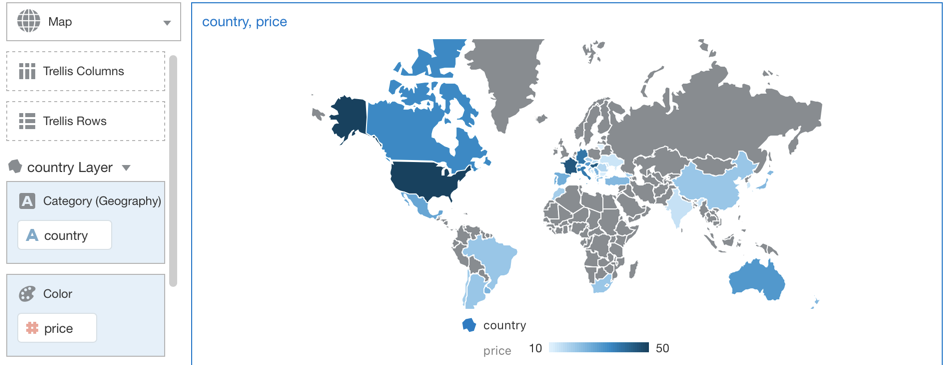
With the raise of OBIEE 11g and 12c the Mapping capability became easier, a new "Map" visualization type was included in the Answers and all we had to do was to match the geographical reference coming from one of our Subject Areas (e.g. Country Name) with the related column containing the shape information (e.g. the Country Shape).
After doing so, we were able to plot our geographical information properly: adding multiple layers, drilling capabilities and tooltips was just a matter of few clicks.
The Secret Source: Good Maps and Data Quality
Perfect, you might think, we can easily use maps everywhere as soon as we have any type of geo-location data available in our dataset! Well, the reality in the old days wasn't like that, Oracle at the time provided some sample maps with a certain level of granularity and covering only some countries in detail. What if we wanted to display all the suburbs of Verona? Sadly that wasn't included so we were forced to either find a free source online or to purchase it from a Vendor.
The source of map shapes was only half of the problem to solve: we always need to create a join with a column coming from our Subject Area! Should we use the Zip Code? What about the Address? Is City name enough? The deeper we were going into the mapping details the more problems were arising.
A common problem (as we saw before about Sydney) was using the City name. How many cities are called the same? How many regions? Is the street name correct? Data quality was and still is crucial to provide accurate data and not only a nice but useless map view.
OAC and the Automatic Mapping Capability
Within OAC, DV offers the Automatic Mapping Capability, we only need to include in a Project a column containing a geographical reference (lat/long, country name etc), select "Map" as visualization type and the tool will choose the most appropriate mapping granularity that matches our dataset.
Great! This solves all our issues! Well... not all of them! The Automatic Mapping capability doesn't have all the possible maps in it, but we can always include new custom maps using the OAC Console if we need them.
So What's New in 105.4?
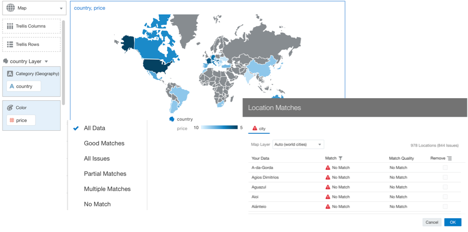
All the above was available way before the latest OAC release. The 105.4 adds the "Maps ambiguous location matches" feature, which means that every time we create a Map View, OAC will provide us with a Location Matches option
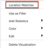
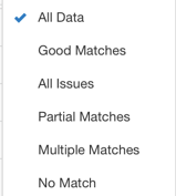
If we click this option OAC will provide as a simple window where we can see:
- How many locations matched
- How many locations have issues
- What's the type of Issue?
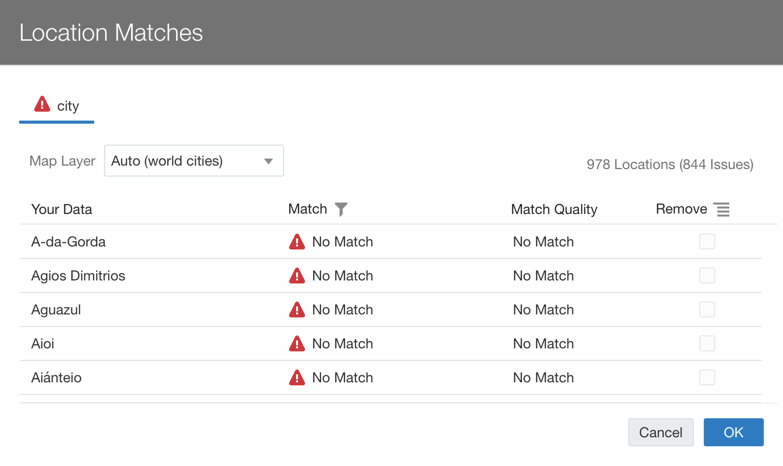
The type of issue can be one between:
No Matchin case OAC doesn't find any comparable geographical valueMultiple Matcheswhen there are multiple possible associationsPartial Matcheswhen there is a match only to part of the content
We can then take this useful information and start a process of data cleaning to raise the quality of our data visualization.
Conclusion
Maps were and are a really important visualization available in OAC. The Maps ambiguous location matches feature provides a way to understand if our visualization is representative of our dataset. So, if you want to avoid spending your honeymoon in the wrong Sydney or if you just want to provide accurate maps on top of your dataset, use this feature available in OAC!